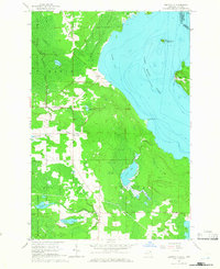
1964 Map of Goetzville
USGS Topo · Published 1966About this map
Saint Marys River defines the eastern edge of this Upper Peninsula landscape, marking the international border between Michigan and Ontario. In the early 1960s, the inland terrain is a mix of dense wetlands and small agricultural clearings, dominated by the Munuscong State Forest and the expansive Gogomain Swamp. An Old Railroad Grade cuts through the forest northwest of Raber, hinting at the area's earlier logging history before these tracks were removed.
Find a feature on this map
30 named features on this map. Tap any name to fly to it.
Don’t see what you’re looking for? This feature index may not catch every label — zoom into the map to look around manually.
Map Details
Editions of this 1964 Goetzville Map
2 editions found
Other maps of this area

1953 · Munuscong
USGS Topo · 1:24,000

1953 · Munuscong NE
USGS Topo · 1:24,000

1954 · Alpena
USGS Topo · 1:250,000

1954 · Sault Sainte Marie
USGS Topo · 1:250,000

1955 · Cheboygan
USGS Topo · 1:250,000

1956 · Sault Sainte Marie
USGS Topo · 1:250,000

1957 · Alpena
USGS Topo · 1:250,000

1957 · Sault Sainte Marie
USGS Topo · 1:250,000

1958 · Cheboygan
USGS Topo · 1:250,000

1958 · Alpena
USGS Topo · 1:250,000