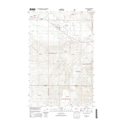
2014 Map of Gold Bar
USGS Topo · Published 2014About this map
The Skykomish River corridor serves as the primary artery for settlement and transport in this corner of the Pacific Northwest. The town of Gold Bar and the village of Startup are positioned along the riverbank, where the BNSF Railway and Us-2 follow the valley floor. This infrastructure supports a transition from the river-level communities to the steep elevations of the Snoqualmie National Forest. South of the river, the terrain rises sharply toward Haystack Mtn, hiding high-altitude water bodies such as Airplane Lake and Halcyon Lake. The northern portion of the map highlights the confluence of the Wallace River and May Cr, with the Wallace River Bridge serving as a key local landmark. Further east, the settlement of Reiter sits at the base of the mountains, marking a point where industry and the wilderness of the national forest boundary meet.
Find a feature on this map
63 named features on this map. Tap any name to fly to it.
Don’t see what you’re looking for? This feature index may not catch every label — zoom into the map to look around manually.
Map Details
Editions of this 2014 Gold Bar Map
This is the sole edition of this map. No revisions or reprints were ever made.
Other maps of this area

1921 · Sultan
USGS Topo · 1:125,000

1923 · Sultan
USGS Topo · 1:125,000

1953 · Sultan
USGS Topo · 1:24,000

1953 · Lake Joy
USGS Topo · 1:24,000

1956 · Monroe
USGS Topo · 1:62,500

1957 · Index
USGS Topo · 1:62,500

1957 · Wenatchee
USGS Topo · 1:250,000

1960 · Mount Si
USGS Topo · 1:62,500
1975 · Skykomish River
USGS Topo · 1:100,000
1986 · Lake Joy
USGS Topo · 1:24,000