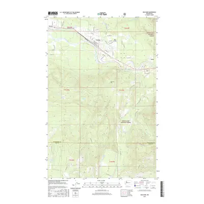
2017 Map of Gold Bar
USGS Topo · Published 2017About this map
Gold Bar and its neighboring settlements sit within a mountain-valley landscape shaped by the confluence of the Skykomish River and the Wallace River. This 2017 topographic survey details the residential street grids of Startup and May Creek, illustrating how development is concentrated along the river corridor while the steep terrain of the Snoqualmie National Forest dominates the surrounding heights. Significant elevation markers like Haystack Mtn overlook the valley floor, where the Burlington railroad line parallels the highway, maintaining a long-standing transportation artery through the Cascade foothills.
Find a feature on this map
69 named features on this map. Tap any name to fly to it.
Don’t see what you’re looking for? This feature index may not catch every label — zoom into the map to look around manually.
Map Details
Editions of this 2017 Gold Bar Map
This is the sole edition of this map. No revisions or reprints were ever made.
Other maps of this area

1921 · Sultan
USGS Topo · 1:125,000

1923 · Sultan
USGS Topo · 1:125,000

1953 · Sultan
USGS Topo · 1:24,000

1953 · Lake Joy
USGS Topo · 1:24,000

1956 · Monroe
USGS Topo · 1:62,500

1957 · Index
USGS Topo · 1:62,500

1957 · Wenatchee
USGS Topo · 1:250,000

1960 · Mount Si
USGS Topo · 1:62,500
1975 · Skykomish River
USGS Topo · 1:100,000
1986 · Lake Joy
USGS Topo · 1:24,000