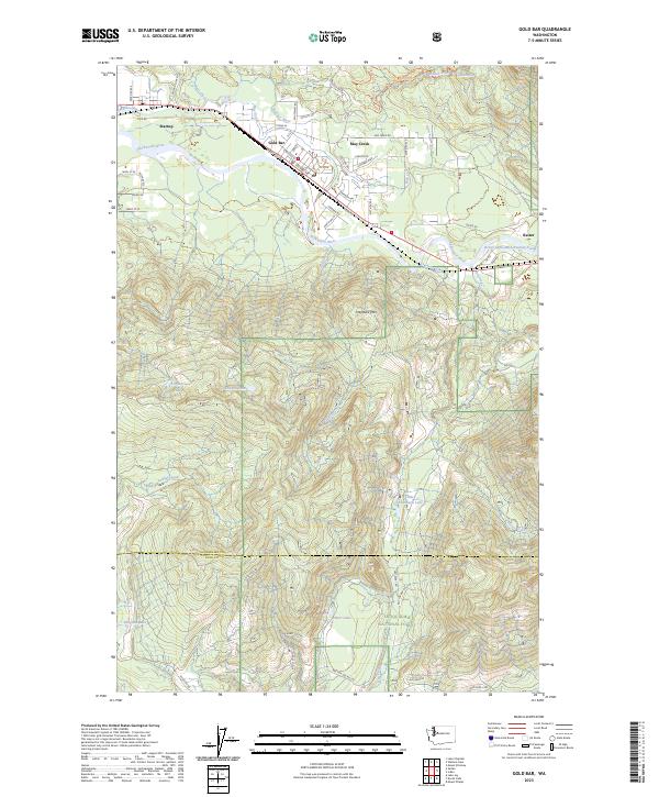
2023 Map of Gold Bar
USGS Topo · Published 2023About this map
The Skykomish River and Wallace River valley serves as the primary corridor for settlement and transit in this region of Snohomish County. The towns of Gold Bar and Startup are the principal population centers, situated along the flat river bottoms before the terrain rises sharply into the surrounding peaks. To the north, Wallace Falls marks a significant drop in the drainage of Bear Creek, while the southern half of the map is dominated by the dense, high-elevation woodlands of the Snoqualmie National Forest.
Find a feature on this map
59 named features on this map. Tap any name to fly to it.
Don’t see what you’re looking for? This feature index may not catch every label — zoom into the map to look around manually.
Map Details
Editions of this 2023 Gold Bar Map
This is the sole edition of this map. No revisions or reprints were ever made.
Other maps of this area

1921 · Sultan
USGS Topo · 1:125,000

1923 · Sultan
USGS Topo · 1:125,000

1953 · Sultan
USGS Topo · 1:24,000

1953 · Lake Joy
USGS Topo · 1:24,000

1956 · Monroe
USGS Topo · 1:62,500

1957 · Index
USGS Topo · 1:62,500

1957 · Wenatchee
USGS Topo · 1:250,000

1960 · Mount Si
USGS Topo · 1:62,500
1975 · Skykomish River
USGS Topo · 1:100,000
1986 · Lake Joy
USGS Topo · 1:24,000