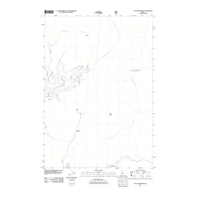
2011 Map of Gold Fork Rock
USGS Topo · Published 2011About this map
Gold Fork Rock and the high peaks of the Needles define this alpine landscape in Valley County, where the headwaters of the North Fork Gold Fork River and South Fork Gold Fork River converge. The terrain is characterized by a network of forest roads, including the winding Gold Fork Loop Rd, which provides access to elevated points like the Gold Fork Lookout. Extensive clearings and grazing grounds are marked at Gold Fork Meadow and Dollar Creek Meadow, suggesting the seasonal utility of this high-country drainage system.
Find a feature on this map
30 named features on this map. Tap any name to fly to it.
Don’t see what you’re looking for? This feature index may not catch every label — zoom into the map to look around manually.
Map Details
Editions of this 2011 Gold Fork Rock Map
This is the sole edition of this map. No revisions or reprints were ever made.
Other maps of this area

1954 · Gold Fork
USGS Topo · 1:62,500

1954 · Warm Lake
USGS Topo · 1:62,500

1957 · Challis
USGS Topo · 1:250,000

1960 · Challis
USGS Topo · 1:250,000

1963 · Challis
USGS Topo · 1:250,000

1973 · Blackmare
USGS Topo · 1:24,000

1973 · White Rock Peak
USGS Topo · 1:24,000
1973 · Paddy Flat
USGS Topo · 1:24,000

1982 · Pistol Creek
USGS Topo · 1:100,000
1988 · Gold Fork Rock
USGS Topo · 1:24,000