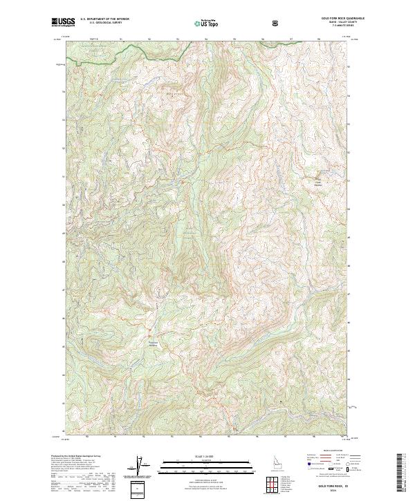
2024 Map of Gold Fork Rock
USGS Topo · Published 2024About this map
Payette National Forest and Boise National Forest converge in this high-elevation Idaho landscape, defined by the intricate headwaters of the Gold Fork River. The central prominence of the Needles overlooks a network of drainage systems including Lodgepole Creek and Foolhen Creek. The presence of the Gold Fork Lookout suggests a history of fire observation and forestry management in this roadless backcountry.
Find a feature on this map
32 named features on this map. Tap any name to fly to it.
Don’t see what you’re looking for? This feature index may not catch every label — zoom into the map to look around manually.
Map Details
Editions of this 2024 Gold Fork Rock Map
This is the sole edition of this map. No revisions or reprints were ever made.
Other maps of this area

1954 · Gold Fork
USGS Topo · 1:62,500

1954 · Warm Lake
USGS Topo · 1:62,500

1957 · Challis
USGS Topo · 1:250,000

1960 · Challis
USGS Topo · 1:250,000

1963 · Challis
USGS Topo · 1:250,000

1973 · Blackmare
USGS Topo · 1:24,000

1973 · White Rock Peak
USGS Topo · 1:24,000
1973 · Paddy Flat
USGS Topo · 1:24,000

1982 · Pistol Creek
USGS Topo · 1:100,000
1988 · Gold Fork Rock
USGS Topo · 1:24,000