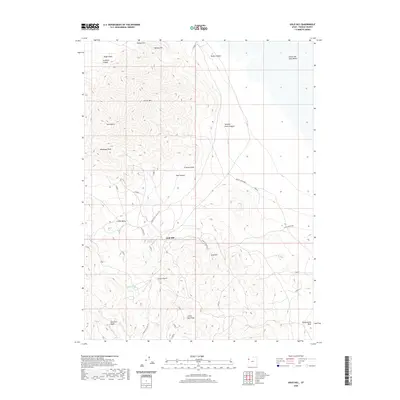
2020 Map of Gold Hill
USGS Topo · Published 2020About this map
Gold Hill sits at the heart of this Tooele County landscape, surrounded by a complex network of canyons and gulches that speak to the area's mining and ranching history. The settlement of Little Valley is positioned to the west, while the vast Great Salt Lake Desert dominates the northeast corner of the sheet. Vital water sources like Cane Spring and Ochre Spring are clearly marked, providing necessary points of reference in an arid environment defined by prominent peaks like Dutch Mtn and Woodman Peak. The topographic detail reveals a landscape carved by seasonal drainages such as Gold Hill Wash and Rodenhouse Wash. Local transit is represented by named corridors including Lower Little Valley Rd and Sage-Thrasher Rd, which connect the scattered mountain features like Lucky Day Knob and Wilson Hill to the valley floors.
Find a feature on this map
25 named features on this map. Tap any name to fly to it.
Don’t see what you’re looking for? This feature index may not catch every label — zoom into the map to look around manually.
Map Details
Editions of this 2020 Gold Hill Map
This is the sole edition of this map. No revisions or reprints were ever made.
Other maps of this area

1925 · Gold Hill
USGS Topo · 1:62,500

1928 · Gold Hill
USGS Topo · 1:62,500

1953 · Tooele
USGS Topo · 1:250,000

1955 · Tooele
USGS Topo · 1:250,000

1972 · Elephant Knoll
USGS Topo · 1:24,000

1972 · Elephant Knoll SE
USGS Topo · 1:24,000
1973 · Ochre Mountain
USGS Topo · 1:24,000
1973 · Gold Hill
USGS Topo · 1:24,000
1973 · Ibapah
USGS Topo · 1:24,000

1973 · Gold Hill 1 SW
USGS Topo · 1:24,000