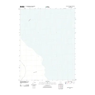
2010 Map of Gold Hill Wash
USGS Topo · Published 2010About this map
Gold Hill Wash defines the drainage patterns of this arid landscape in Tooele County, cutting across the terrain toward the east. This 2010 topographic record captures a remote section of the Utah desert where historical land use is signaled by long-established routes such as Callao Rd. Further south, Rodenhouse Wash traverses the valley floor, highlighting the significant ephemeral waterways that dictate the region's physical geography. The map illustrates the stark intersection between infrequent human infrastructure and the natural hydrological features that have likely guided travel in this area for generations.
Find a feature on this map
3 named features on this map. Tap any name to fly to it.
Don’t see what you’re looking for? This feature index may not catch every label — zoom into the map to look around manually.
Map Details
Editions of this 2010 Gold Hill Wash Map
This is the sole edition of this map. No revisions or reprints were ever made.
Other maps of this area

1925 · Gold Hill
USGS Topo · 1:62,500

1928 · Gold Hill
USGS Topo · 1:62,500

1953 · Tooele
USGS Topo · 1:250,000

1955 · Tooele
USGS Topo · 1:250,000

1972 · Elephant Knoll SE
USGS Topo · 1:24,000
1973 · Gold Hill 4 SE
USGS Topo · 1:24,000
1973 · Gold Hill
USGS Topo · 1:24,000

1973 · Gold Hill 1 SE
USGS Topo · 1:24,000

1973 · Gold Hill 1 SW
USGS Topo · 1:24,000
1973 · Gold Hill 4 NE
USGS Topo · 1:24,000