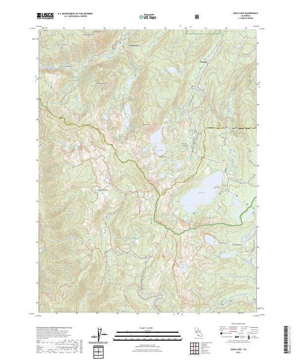
2023 Map of Gold Lake
USGS Topo · Published 2023About this map
Johnsville and Graeagle anchor the high country of the Sierra Nevada, where the headwaters of the Feather River system originate. This modern survey illustrates a landscape defined by its alpine basins and historical mining legacy, with notable heights like Eureka Peak and Mt Elwell rising over the Lakes Basin region. The terrain is crisscrossed by a network of specialized routes, including the Pacific Crest National Scenic Trl and the Gold Valley Ohv Trl, reflecting the area's contemporary role as a recreation hub within the Plumas National Forest and Tahoe National Forest.
Find a feature on this map
53 named features on this map. Tap any name to fly to it.
Don’t see what you’re looking for? This feature index may not catch every label — zoom into the map to look around manually.
Map Details
Editions of this 2023 Gold Lake Map
This is the sole edition of this map. No revisions or reprints were ever made.
Other maps of this area

1891 · Downieville
USGS Topo · 1:125,000

1893 · Downieville
USGS Topo · 1:125,000

1895 · Downieville
USGS Topo · 1:125,000

1896 · Downieville
USGS Topo · 1:125,000

1897 · Downieville
USGS Topo · 1:125,000

1937 · Blairsden
USGS Topo · 1:48,000

1943 · Blairsden
USGS Topo · 1:62,500
1951 · Mt. Fillmore
USGS Topo · 1:24,000
1951 · Downieville
USGS Topo · 1:24,000
1951 · Blue Nose Mtn
USGS Topo · 1:24,000