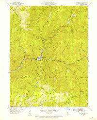
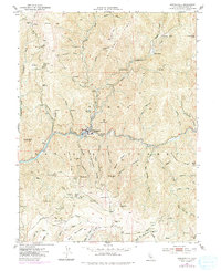
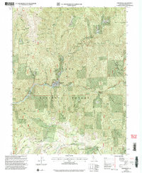
1951 Map of Downieville
USGS Topo · Published 1953About this map
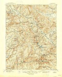
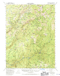
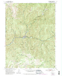
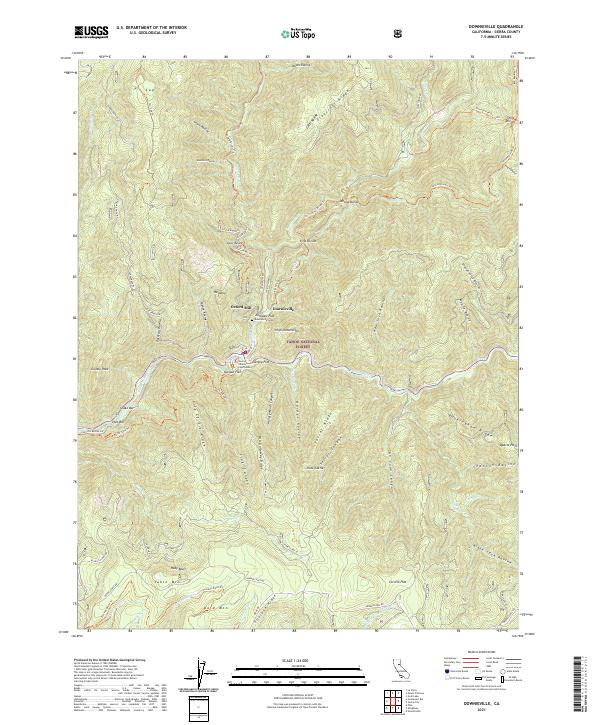
Downieville sits at the confluence of the Downie River and the North Fork Yuba River, serving as a central hub for the extensive gold mining operations etched into the surrounding ridges. This mid-century survey illustrates an intensive history of extraction, featuring numerous hard-rock sites such as the Gold Bluff Mine, Oxford Mine & Mill, and the Monte Cristo Mine. The landscape is a complex network of steep ravines and ridges, including Craycroft Ridge and Galloway Ridge, where water was a critical tool for development. Evidence of early hydraulic or placer work persists in names like Craycroft Diggings, while former habitations are noted at the Cornish House and Pliocene Mine. Genealogists may find interest in named locations like Lavezzola Ranch and Oak Ranch, which reflect the small-scale agricultural support for the mountain mining industry within the Tahoe National Forest.
Find a feature on this map
77 named features on this map. Tap any name to fly to it.
Don’t see what you’re looking for? This feature index may not catch every label — zoom into the map to look around manually.
Map Details
Editions of this 1951 Downieville Map
6 editions found
Historical Maps of Downieville Through Time
12 maps found

1891 Downieville
Sierra County, CA

1893 Downieville
Sierra County, CA

1895 Downieville
Sierra County, CA

1896 Downieville
Sierra County, CA
1897 Downieville
Sierra County, CA
1951 Downieville
Sierra County, CA
1951 Downieville
Sierra County, CA
2000 Downieville
Sierra County, CA
2012 Downieville
Sierra County, CA
2015 Downieville
Sierra County, CA
2018 Downieville
Sierra County, CA
2021 Downieville
Sierra County, CA