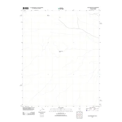
2012 Map of Gold Mountain
USGS Topo · Published 2012About this map
The Gold Mountain Range dominates this portion of Inyo County, defining a landscape of high-desert elevations and intermittent water sources. Central to the topography is the peak of Gold Mountain itself, a landmark that once guided early prospectors through this arid corridor between California and Nevada. In this environment, specific hydrological features like Willow Spring are crucial markers of the region's geography, indicating the sparse but vital locations where water reaches the surface. The map illustrates a primarily undeveloped wilderness, reflecting the persistent character of this remote borderland into the twenty-first century, where the absence of dense infrastructure highlights the topographical challenges of the Great Basin terrain.
Find a feature on this map
3 named features on this map. Tap any name to fly to it.
Don’t see what you’re looking for? This feature index may not catch every label — zoom into the map to look around manually.
Map Details
Editions of this 2012 Gold Mountain Map
This is the sole edition of this map. No revisions or reprints were ever made.
Other maps of this area

1908 · Lida
USGS Topo · 1:250,000

1913 · Lida
USGS Topo · 1:250,000

1954 · Goldfield
USGS Topo · 1:250,000

1955 · Goldfield
USGS Topo · 1:250,000

1957 · Ubehebe Crater
USGS Topo · 1:62,500

1958 · Goldfield
USGS Topo · 1:250,000

1962 · Goldfield
USGS Topo · 1:250,000
1968 · Gold Point SW
USGS Topo · 1:24,000
1968 · Bonnie Claire NW
USGS Topo · 1:24,000
1968 · Gold Point
USGS Topo · 1:24,000