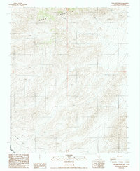
1988 Map of Gold Mountain
USGS Topo · Published 1988About this map
Gold Mountain dominates this high-desert landscape along the border of Esmeralda County, Nevada, and Inyo County, California. The terrain is defined by complex contouring and remote water sources like Willow Spring, which provided a critical point of survival in this arid environment. The map documents evidence of early mineral exploration, specifically noting several prospects on the eastern slopes, indicating the region's draw for 19th and early 20th-century miners. A notable historical boundary line, the Von Schmidt line, cuts across the southern portion of the quadrangle. This survey line represents the original 1872–1873 boundary attempt between the two states, often found on maps of this era to mark the discrepancy between historical surveying and the modern state line.
Find a feature on this map
7 named features on this map. Tap any name to fly to it.
Don’t see what you’re looking for? This feature index may not catch every label — zoom into the map to look around manually.
Map Details
Editions of this 1988 Gold Mountain Map
This is the sole edition of this map. No revisions or reprints were ever made.
Other maps of this area

1908 · Lida
USGS Topo · 1:250,000

1913 · Lida
USGS Topo · 1:250,000

1954 · Goldfield
USGS Topo · 1:250,000

1955 · Goldfield
USGS Topo · 1:250,000

1957 · Ubehebe Crater
USGS Topo · 1:62,500

1958 · Goldfield
USGS Topo · 1:250,000

1962 · Goldfield
USGS Topo · 1:250,000
1968 · Gold Point SW
USGS Topo · 1:24,000
1968 · Bonnie Claire NW
USGS Topo · 1:24,000
1968 · Gold Point
USGS Topo · 1:24,000