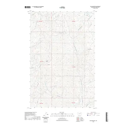
2020 Map of Gold Mountain
USGS Topo · Published 2020About this map
Gold Mtn and the adjacent Gold Mtn Ridge dominate the central landscape of this Ferry County region, marking a terrain defined by high ridges and a dense network of mountain drainages. The area is part of a complex hydrologic system where Wilmont Cr and its tributaries, including Little Wilmont Cr and Three Forks Cr, carve through the upland country. To the north, the presence of South Twin Lake and the Little Twin Lakes suggests a transition toward the lake-rich topography characteristic of the Colville Indian Reservation area. The road system, comprised of routes like Wilmont Creek RD and the Twin Lakes - Nez Perce RD, follows the natural contours of the valleys, illustrating how transportation in this part of Washington is dictated by the steep mountain passes and gaps, such as Bear Hide Gap.
Find a feature on this map
33 named features on this map. Tap any name to fly to it.
Don’t see what you’re looking for? This feature index may not catch every label — zoom into the map to look around manually.
Map Details
Editions of this 2020 Gold Mountain Map
This is the sole edition of this map. No revisions or reprints were ever made.
Other maps of this area

1948 · Wilmont Creek
USGS Topo · 1:62,500

1950 · Wilmont Creek
USGS Topo · 1:62,500

1952 · Keller
USGS Topo · 1:62,500

1952 · Twin Lakes
USGS Topo · 1:62,500

1953 · Seventeenmile Mtn.
USGS Topo · 1:62,500

1954 · Okanogan
USGS Topo · 1:250,000

1956 · Wilmont Creek
USGS Topo · 1:62,500

1958 · Okanogan
USGS Topo · 1:250,000

1984 · Nespelem
USGS Topo · 1:100,000
1985 · Moon Mountain
USGS Topo · 1:24,000