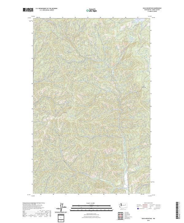
2023 Map of Gold Mountain
USGS Topo · Published 2023About this map
Gold Mountain and the high spine of Gold Mountain Ridge dominate this interior landscape of Ferry County. The area is defined by a dense drainage network where Wilmont Creek and Three Forks Creek carve through the terrain, joined by smaller tributaries like Fay Creek and Gallear Creek. In the northeastern corner, the South Twin Lake Reservoir and Little Twin Lakes represent the primary water storage features, with Bear Hide Gap marking a notable natural pass in the topography. A series of Bureau of Indian Affairs and local roads, such as Wilmont Creek Twin Lakes Rd and the Twin Lakes - Nez Perce Rd, provide the only access through these highlands. The map shows a landscape largely shaped by its hydrology and relief, with various creek branches like Nez Perce Creek and Rock Creek creating a complex web of valleys beneath the primary ridges.
Find a feature on this map
31 named features on this map. Tap any name to fly to it.
Don’t see what you’re looking for? This feature index may not catch every label — zoom into the map to look around manually.
Map Details
Editions of this 2023 Gold Mountain Map
This is the sole edition of this map. No revisions or reprints were ever made.
Other maps of this area

1948 · Wilmont Creek
USGS Topo · 1:62,500

1950 · Wilmont Creek
USGS Topo · 1:62,500

1952 · Keller
USGS Topo · 1:62,500

1952 · Twin Lakes
USGS Topo · 1:62,500

1953 · Seventeenmile Mtn.
USGS Topo · 1:62,500

1954 · Okanogan
USGS Topo · 1:250,000

1956 · Wilmont Creek
USGS Topo · 1:62,500

1958 · Okanogan
USGS Topo · 1:250,000

1984 · Nespelem
USGS Topo · 1:100,000
1985 · Moon Mountain
USGS Topo · 1:24,000