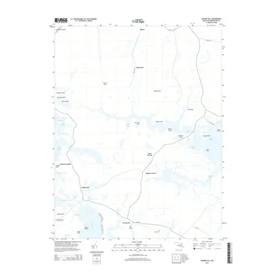
2014 Map of Golden Hill
USGS Topo · Published 2014About this map
The Honga River and its intricate network of tidal guts and marshes define this low-lying portion of Dorchester County. Small settlements and local landmarks like Golden Hill, Harrisville, and Walnut Landing are linked by a sparse road network, including MD-336 and Harrisville Rd. The map reveals a landscape heavily influenced by its proximity to the Chesapeake Bay, where named necks like Susquehanna Neck, Peters Neck, and Wheatley Neck reach into the surrounding waters and wetlands. Family history and local heritage are preserved in sites such as Saint Mary Star of the Sea Cem, Saint Johns Cem, and Gootee Cem. The geography here is a complex arrangement of islands and coves, from Woolford Island in the west to the tidal channels of Piney Gut and Hog Marsh Gut, illustrating the delicate balance between the land and the rising tides of the Eastern Shore.
Find a feature on this map
49 named features on this map. Tap any name to fly to it.
Don’t see what you’re looking for? This feature index may not catch every label — zoom into the map to look around manually.
Map Details
Editions of this 2014 Golden Hill Map
This is the sole edition of this map. No revisions or reprints were ever made.
Other maps of this area

1892 · Drum Point
USGS Topo · 1:62,500

1893 · Sharps Island
USGS Topo · 1:62,500

1898 · Choptank
USGS Topo · 1:125,000

1898 · St. Marys
USGS Topo · 1:125,000

1901 · Drum Point
USGS Topo · 1:62,500

1904 · Sharps Island
USGS Topo · 1:62,500

1904 · Oxford
USGS Topo · 1:62,500

1905 · Crapo
USGS Topo · 1:62,500

1905 · Drum Point
USGS Topo · 1:62,500

1906 · St. Marys
USGS Topo · 1:125,000