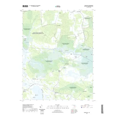
2019 Map of Golden Hill
USGS Topo · Published 2019About this map
The expansive wetlands of the Blackwater National Wildlife Refuge dominate this Dorchester County landscape, preserving the tidal marshes and timbered islands of the Chesapeake Bay's eastern shore. This territory is deeply connected to the legacy of the Underground Railroad, with the Harriet Tubman Underground Railroad National Historical Park and the Tubman Trail marking the very woods and waterways where freedom seekers once navigated. Small crossroads settlements like Harrisville, Golden Hill, and Riggins Corner are connected by a network of low-lying roads such as Hip Roof Rd and Hoopers Island Rd. Genealogists will find significance in several historic burial sites, including the Saint Mary Star of the Sea Catholic Cem near Meekins Neck and the Gootee Family Cem situated near the headwaters of Worlds End Creek. The map details a complex hydrologic system where the Blackwater River meets named guts, creeks, and marshes like Hog Marsh Gut and Hell Hook Marsh.
Find a feature on this map
84 named features on this map. Tap any name to fly to it.
Don’t see what you’re looking for? This feature index may not catch every label — zoom into the map to look around manually.
Map Details
Editions of this 2019 Golden Hill Map
This is the sole edition of this map. No revisions or reprints were ever made.
Other maps of this area

1892 · Drum Point
USGS Topo · 1:62,500

1893 · Sharps Island
USGS Topo · 1:62,500

1898 · Choptank
USGS Topo · 1:125,000

1898 · St. Marys
USGS Topo · 1:125,000

1901 · Drum Point
USGS Topo · 1:62,500

1904 · Sharps Island
USGS Topo · 1:62,500

1904 · Oxford
USGS Topo · 1:62,500

1905 · Crapo
USGS Topo · 1:62,500

1905 · Drum Point
USGS Topo · 1:62,500

1906 · St. Marys
USGS Topo · 1:125,000