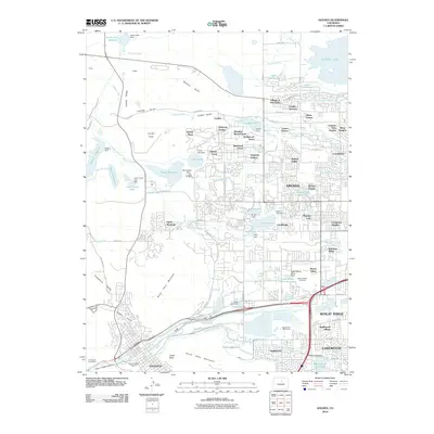
2010 Map of Golden
USGS Topo · Published 2010About this map
Golden and its surrounding geological landmarks define this transition from the Great Plains into the foothills of the Front Range. The landscape is dominated by the volcanic plateaus of North Table Mountain and South Table Mountain, with the iconic spire of Castle Rock standing at the edge of the city. To the north, the small community of Leyden and the Village of Five Parks illustrate the ongoing suburban expansion into the high prairie. The map shows a complex hydraulic network necessary for the region's development, including the Croke Canal, Welch Ditch, and Agricultural Ditch.
Find a feature on this map
108 named features on this map. Tap any name to fly to it.
Don’t see what you’re looking for? This feature index may not catch every label — zoom into the map to look around manually.
Map Details
Editions of this 2010 Golden Map
This is the sole edition of this map. No revisions or reprints were ever made.
Other maps of this area

1899 · West Denver
USGS Topo · 1:125,000

1906 · Blackhawk
USGS Topo · 1:62,500

1938 · Morrison
USGS Topo · 1:24,000

1939 · Golden
USGS Topo · 1:24,000

1940 · Lafayette
USGS Topo · 1:31,680

1941 · Arvada
USGS Topo · 1:31,680

1941 · Fort Logan
USGS Topo · 1:31,680

1942 · Eldorado Springs
USGS Topo · 1:24,000

1942 · Morrison
USGS Topo · 1:31,680

1942 · Golden
USGS Topo · 1:31,680