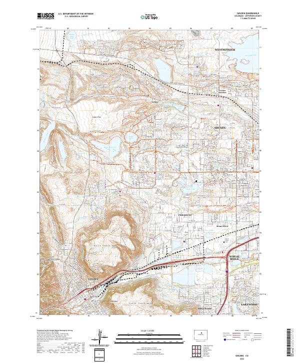
2022 Map of Golden
USGS Topo · Published 2022About this map
Golden serves as the focal point of this Jefferson County survey, where the historic Colorado School of Mines and Parfet Park sit at the base of the foothills. The landscape is defined by the massive basalt caps of North Table Mtn and South Table Mtn, which frame the town and preserve its geological identity amidst modern suburban expansion. The era of extraction is still visible along the Old Quarry Trl, while the region's agricultural roots are traced through an extensive network of irrigation features like the Wannamaker Ditch and Croke Canal.
Find a feature on this map
95 named features on this map. Tap any name to fly to it.
Don’t see what you’re looking for? This feature index may not catch every label — zoom into the map to look around manually.
Map Details
Editions of this 2022 Golden Map
This is the sole edition of this map. No revisions or reprints were ever made.
Other maps of this area

1899 · West Denver
USGS Topo · 1:125,000

1906 · Blackhawk
USGS Topo · 1:62,500

1938 · Morrison
USGS Topo · 1:24,000

1939 · Golden
USGS Topo · 1:24,000

1940 · Lafayette
USGS Topo · 1:31,680

1941 · Arvada
USGS Topo · 1:31,680

1941 · Fort Logan
USGS Topo · 1:31,680

1942 · Eldorado Springs
USGS Topo · 1:24,000

1942 · Morrison
USGS Topo · 1:31,680

1942 · Golden
USGS Topo · 1:31,680