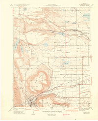
1944 Map of Golden
USGS Topo · Published 1944About this map
The dramatic geography of the Colorado Front Range dominates this 1939 survey, where the town of Golden sits at the base of the massive basalt-capped mesas of North Table Mountain and South Table Mountain. This mid-century landscape is defined by its water management systems, featuring a dense network of irrigation channels like the Farmers Highline Canal and numerous reservoirs including Standley Lake and Ralston Reservoir. These systems supported the agricultural transition of the plains while the Denver and Intermountain transit lines provided critical connection to the state capital.
Find a feature on this map
47 named features on this map. Tap any name to fly to it.
Don’t see what you’re looking for? This feature index may not catch every label — zoom into the map to look around manually.
Map Details
Editions of this 1944 Golden Map
This is the sole edition of this map. No revisions or reprints were ever made.
Other maps of this area

1899 · West Denver
USGS Topo · 1:125,000

1906 · Blackhawk
USGS Topo · 1:62,500

1938 · Morrison
USGS Topo · 1:24,000

1939 · Golden
USGS Topo · 1:24,000

1940 · Lafayette
USGS Topo · 1:31,680

1941 · Arvada
USGS Topo · 1:31,680

1941 · Fort Logan
USGS Topo · 1:31,680

1942 · Eldorado Springs
USGS Topo · 1:24,000

1942 · Morrison
USGS Topo · 1:31,680

1942 · Golden
USGS Topo · 1:31,680