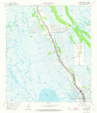
1964 Map of Golden Meadow
USGS Topo · Published 1973About this map
Bayou Lafourche serves as the central artery for this coastal Louisiana landscape, where settlement is tightly confined to the natural levees bordering the water. In the mid-1960s, the linear communities of Belle Amie, Galliano, and Golden Meadow form a nearly continuous ribbon of development, supported by a network of drainage canals and pumping stations that manage the surrounding marshland. The economy is visibly dominated by the energy sector, with the Bully Camp Oil and Gas Field and Golden Meadow Oil and Gas Field encroaching on the wetlands. Local heritage is preserved in numerous family burial grounds including Cheramie Cem and Pitre Cem, while the Tidelands Country Club and St Joseph Ch mark the social and spiritual centers of the parish. To the west, the expanse of Catfish Lake and Lake Cheniere illustrates the precarious balance between dry land and the encroaching Gulf waters.
Find a feature on this map
32 named features on this map. Tap any name to fly to it.
Don’t see what you’re looking for? This feature index may not catch every label — zoom into the map to look around manually.
Map Details
Editions of this 1964 Golden Meadow Map
3 editions found
Other maps of this area

1892 · Barataria
USGS Topo · 1:62,500

1892 · Cut-Off
USGS Topo · 1:62,500

1892 · Creole
USGS Topo · 1:62,500

1894 · Lake Felicity
USGS Topo · 1:62,500

1935 · Viguerie Canal
USGS Topo · 1:31,680

1935 · Bay Courant
USGS Topo · 1:31,680

1935 · Golden Meadow
USGS Topo · 1:31,680

1935 · Mink Bayou
USGS Topo · 1:31,680

1939 · Cut-Off
USGS Topo · 1:62,500

1939 · Lake Felicity
USGS Topo · 1:62,500