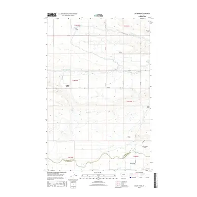
2017 Map of Golden Ridge
USGS Topo · Published 2017About this map
The Sun River winds through the southern edge of this landscape, marking the border between Teton and Lewis and Clark Counties. This region is defined by an extensive network of irrigation infrastructure essential to High Plains agriculture, including the Spring Valley Canal, the Sun River Slope Canal, and the Floweree Canal. These man-made waterways cut across a terrain naturally sculpted by numerous coulees, such as Big Coulee and Silve Coulee.
Find a feature on this map
35 named features on this map. Tap any name to fly to it.
Don’t see what you’re looking for? This feature index may not catch every label — zoom into the map to look around manually.
Map Details
Editions of this 2017 Golden Ridge Map
This is the sole edition of this map. No revisions or reprints were ever made.
Other maps of this area

1920 · Choteau
USGS Topo · 1:125,000

1943 · Hogan
USGS Topo · 1:125,000

1955 · Choteau
USGS Topo · 1:250,000

1957 · Choteau
USGS Topo · 1:250,000

1958 · Choteau
USGS Topo · 1:250,000

1960 · Gilman
USGS Topo · 1:62,500
1960 · Freezeout Lake
USGS Topo · 1:62,500

1962 · Choteau
USGS Topo · 1:250,000
1963 · Bowmans Corners NW
USGS Topo · 1:24,000
1963 · Bowmans Corners NE
USGS Topo · 1:24,000