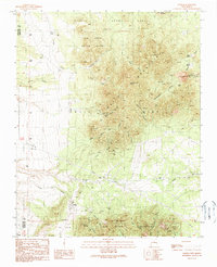
1990 Map of Golden
USGS Topo · Published 1990About this map
The settlement of Golden serves as the focal point for this landscape defined by the mining legacy of the Ortiz Mountains and the San Pedro Mountains. Evidence of mineral extraction is pervasive, from the Ortiz Mine and Gypsy Queen Mine to the numerous prospects and adits lining the canyons. The map illustrates a complex network of arroyos and gulches, including Arroyo Tuerto and Cunningham Gulch, which have historically shaped both the topography and the human geography of the region. Scattered holdings like Dolores Ranch and Glenn Ranch indicate a sparse ranching presence alongside the industrial works. High points like Placer Mountain and Cunningham Hill provide vantage points over a terrain where geological wealth dictated the placement of roads and camps like Boxcar Camp.
Find a feature on this map
53 named features on this map. Tap any name to fly to it.
Don’t see what you’re looking for? This feature index may not catch every label — zoom into the map to look around manually.
Map Details
Editions of this 1990 Golden Map
2 editions found
Other maps of this area

1892 · San Pedro
USGS Topo · 1:125,000

1954 · Sandia Park
USGS Topo · 1:24,000

1954 · San Pedro
USGS Topo · 1:24,000

1954 · San Felipe Pueblo NE
USGS Topo · 1:24,000

1954 · Hagan
USGS Topo · 1:24,000

1954 · San Felipe Pueblo
USGS Topo · 1:62,500

1956 · Edgewood
USGS Topo · 1:62,500

1958 · Albuquerque
USGS Topo · 1:250,000

1961 · Madrid
USGS Topo · 1:62,500

1962 · Albuquerque
USGS Topo · 1:250,000