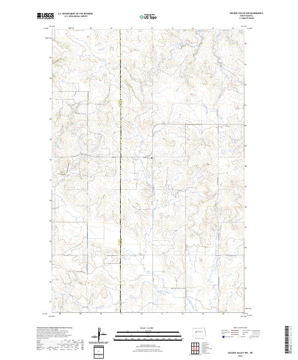
2024 Map of Golden Valley NW
USGS Topo · Published 2024About this map
The rolling grasslands along the border of Dunn and Mercer counties are defined by a network of drainage creeks and rural roads. Goodman Creek flows south through the center of the sheet, joined by Horse Creek in the south and Hans Creek in the west, illustrating the natural water management of this agricultural prairie. The presence of Defiance Cem near the center of the map provides a vital landmark for genealogists tracing early families in this portion of the Missouri Plateau. Transportation is marked by a mix of county routes like Co Rd 1 and Co Rd 2, while the Frei Private Airport indicates the modern logistical needs of these large-scale ranching and farming operations. The map also documents tribal infrastructure with Bia Rd 11 appearing in the northern reaches, reflecting the jurisdictional complexity of the region.
Find a feature on this map
22 named features on this map. Tap any name to fly to it.
Don’t see what you’re looking for? This feature index may not catch every label — zoom into the map to look around manually.
Map Details
Editions of this 2024 Golden Valley NW Map
This is the sole edition of this map. No revisions or reprints were ever made.
Other maps of this area

1953 · Watford City
USGS Topo · 1:250,000

1957 · Watford City
USGS Topo · 1:250,000

1967 · Watford City
USGS Topo · 1:250,000

1967 · Raub SE
USGS Topo · 1:24,000

1967 · Twin Buttes
USGS Topo · 1:24,000

1970 · Halliday NE
USGS Topo · 1:24,000

1970 · Hay Flat
USGS Topo · 1:24,000
1970 · Golden Valley NE
USGS Topo · 1:24,000

1970 · Golden Valley NW
USGS Topo · 1:24,000

1973 · Halliday
USGS Topo · 1:24,000