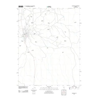
2012 Map of Goldfield
USGS Topo · Published 2012About this map
Goldfield occupies the western edge of this desert landscape, its grid of streets including Broadway and Myrtle St serving as a hub for the surrounding mining district. To the north, the Columbia Post Office and the Columbia Mill mark the site of significant early industrial activity near Columbia Mountain. The terrain is characterized by a series of prominent peaks and ridges that define the local geography, such as Vindicator Mountain, Banner Mountain, and the volcanic profile of Malpais Mesa to the west.
Find a feature on this map
35 named features on this map. Tap any name to fly to it.
Don’t see what you’re looking for? This feature index may not catch every label — zoom into the map to look around manually.
Map Details
Editions of this 2012 Goldfield Map
This is the sole edition of this map. No revisions or reprints were ever made.
Other maps of this area

1908 · Lida
USGS Topo · 1:250,000

1913 · Lida
USGS Topo · 1:250,000

1945 · Goldfield
USGS Topo · 1:125,000

1952 · Mud Lake
USGS Topo · 1:62,500

1952 · Goldfield
USGS Topo · 1:62,500

1954 · Goldfield
USGS Topo · 1:250,000

1955 · Goldfield
USGS Topo · 1:250,000

1958 · Goldfield
USGS Topo · 1:250,000

1962 · Goldfield
USGS Topo · 1:250,000
1970 · Montezuma Peak SE
USGS Topo · 1:24,000