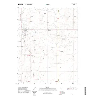
2018 Map of Goldfield
USGS Topo · Published 2018About this map
Goldfield occupies the western edge of this Nevada high-desert survey, where the grid of historic streets like Aluminum St, Main St, and Miners Ave meets the steep, mineral-rich terrain of the Goldfield Hills. The town's proximity to Columbia Mtn and Vindicator Mtn hints at the deep connection between the settlement and the surrounding geology. To the east, the landscape is defined by a series of prominent peaks and washes, including Banner Mtn, Preble Mtn, and the wide course of Big Wash.
Find a feature on this map
48 named features on this map. Tap any name to fly to it.
Don’t see what you’re looking for? This feature index may not catch every label — zoom into the map to look around manually.
Map Details
Editions of this 2018 Goldfield Map
This is the sole edition of this map. No revisions or reprints were ever made.
Other maps of this area

1908 · Lida
USGS Topo · 1:250,000

1913 · Lida
USGS Topo · 1:250,000

1945 · Goldfield
USGS Topo · 1:125,000

1952 · Mud Lake
USGS Topo · 1:62,500

1952 · Goldfield
USGS Topo · 1:62,500

1954 · Goldfield
USGS Topo · 1:250,000

1955 · Goldfield
USGS Topo · 1:250,000

1958 · Goldfield
USGS Topo · 1:250,000

1962 · Goldfield
USGS Topo · 1:250,000
1970 · Montezuma Peak SE
USGS Topo · 1:24,000