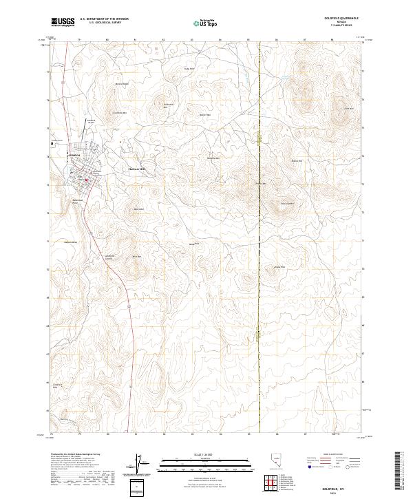
2021 Map of Goldfield
USGS Topo · Published 2021About this map
Goldfield remains a focal point of this high-desert landscape, dominated by a grid of streets such as Main St and Miners Ave that speak to its mineral-rich heritage. As the county seat, the town is anchored by the Esmeralda County Courthouse, while the nearby Goldfield Cem and Goldfield Airport mark the northern and western limits of the primary settlement. The terrain is defined by a dense concentration of named peaks and ridges, including Columbia Mtn, Vindicator Mtn, and Florence Hill, many of which were historically central to the region's mining operations.
Find a feature on this map
53 named features on this map. Tap any name to fly to it.
Don’t see what you’re looking for? This feature index may not catch every label — zoom into the map to look around manually.
Map Details
Editions of this 2021 Goldfield Map
This is the sole edition of this map. No revisions or reprints were ever made.
Other maps of this area

1908 · Lida
USGS Topo · 1:250,000

1913 · Lida
USGS Topo · 1:250,000

1945 · Goldfield
USGS Topo · 1:125,000

1952 · Mud Lake
USGS Topo · 1:62,500

1952 · Goldfield
USGS Topo · 1:62,500

1954 · Goldfield
USGS Topo · 1:250,000

1955 · Goldfield
USGS Topo · 1:250,000

1958 · Goldfield
USGS Topo · 1:250,000

1962 · Goldfield
USGS Topo · 1:250,000
1970 · Montezuma Peak SE
USGS Topo · 1:24,000