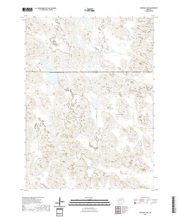
2021 Map of Goldman Lake
USGS Topo · Published 2021About this map
Goldman Lake sits at the northern edge of this Nebraska landscape, straddling the boundary between Brown and Blaine counties. This remote section of the Sandhills is defined by the broad depression of German Valley, which cuts through the undulating terrain in the southern half of the sheet. The area remains sparsely developed, characterized by a complex network of wetlands and intermittent water bodies that follow the natural contours of the valley floor. Transportation is limited to a few local routes such as German Valley Rd and Co Rd 4-24, which provide access to the vast ranching land. The Public Land Survey System grid provides the primary structure for the region, clearly marking townships such as t24n r23w and t24n r22w that define property and jurisdictional lines in this rural interior.
Find a feature on this map
10 named features on this map. Tap any name to fly to it.
Don’t see what you’re looking for? This feature index may not catch every label — zoom into the map to look around manually.
Map Details
Editions of this 2021 Goldman Lake Map
This is the sole edition of this map. No revisions or reprints were ever made.
Other maps of this area

1949 · Koshopah
USGS Topo · 1:62,500

1951 · Dunning
USGS Topo · 1:62,500

1951 · Koshopah
USGS Topo · 1:62,500

1952 · Brewster
USGS Topo · 1:24,000

1952 · Brewster NW
USGS Topo · 1:24,000

1954 · North Platte
USGS Topo · 1:250,000

1955 · Broken Bow
USGS Topo · 1:250,000

1955 · O'Neill
USGS Topo · 1:250,000

1956 · Broken Bow
USGS Topo · 1:250,000

1956 · North Platte
USGS Topo · 1:250,000