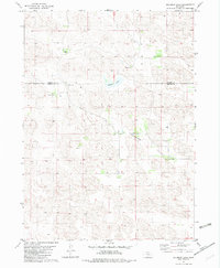
1982 Map of Goldman Lake
USGS Topo · Published 1982About this map
The German Valley defines the lower half of this landscape, where the Sandhills of northern Nebraska meet the ranching traditions of the early 1970s. This survey, edited in 1982, reveals a sparsely populated terrain dominated by large family holdings. These include the Black Ranch and Johnston Ranch to the north, and the Schneidereit Ranch situated centrally near the valley floor. Water management is central to life in this arid region, as evidenced by the namesake Goldman Lake and numerous wells scattered across the map to support livestock. The boundary between Brown County and Blaine County cuts across the northern section, marking a political division in an otherwise continuous stretch of dune-like topography. For genealogists and local historians, the specific placement of individual ranch houses like the Blake Ranch and Pickering Ranch provides a precise record of late 20th-century land use.
Find a feature on this map
13 named features on this map. Tap any name to fly to it.
Don’t see what you’re looking for? This feature index may not catch every label — zoom into the map to look around manually.
Map Details
Editions of this 1982 Goldman Lake Map
This is the sole edition of this map. No revisions or reprints were ever made.
Other maps of this area

1949 · Koshopah
USGS Topo · 1:62,500

1951 · Dunning
USGS Topo · 1:62,500

1951 · Koshopah
USGS Topo · 1:62,500

1952 · Brewster
USGS Topo · 1:24,000

1952 · Brewster NW
USGS Topo · 1:24,000

1954 · North Platte
USGS Topo · 1:250,000

1955 · Broken Bow
USGS Topo · 1:250,000

1955 · O'Neill
USGS Topo · 1:250,000

1956 · Broken Bow
USGS Topo · 1:250,000

1956 · North Platte
USGS Topo · 1:250,000