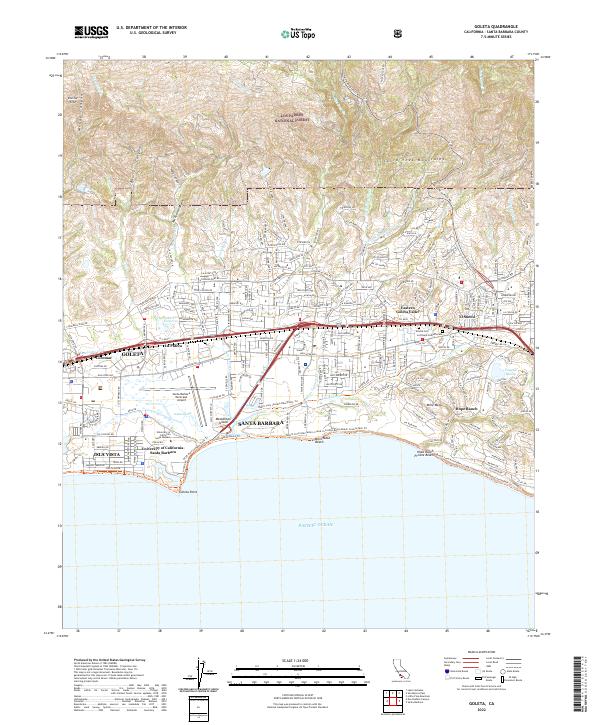
2022 Map of Goleta
USGS Topo · Published 2022About this map
Los Padres National Forest anchors the northern reaches of this coastal landscape, where the southern slopes of the Santa Ynez Mountains drop toward the Pacific. The area is defined by the complex interface of wetlands and urban development, notably around the Goleta Slough and the prominent Santa Barbara Municipal Airport. The landscape transitions from the protected hillsides through residential pockets like La Patera and El Sueno, down to the extensive shoreline features of More Mesa Beach and Goleta Point.
Find a feature on this map
50 named features on this map. Tap any name to fly to it.
Don’t see what you’re looking for? This feature index may not catch every label — zoom into the map to look around manually.
Map Details
Editions of this 2022 Goleta Map
This is the sole edition of this map. No revisions or reprints were ever made.
Other maps of this area

1902 · Santa Ynez
USGS Topo · 1:125,000

1905 · Santa Ynez
USGS Topo · 1:125,000

1941 · San Rafael Mtn.
USGS Topo · 1:62,500

1942 · Goleta
USGS Topo · 1:62,500

1942 · San Rafael Mtn.
USGS Topo · 1:62,500

1942 · Little Pine Mountain
USGS Topo · 1:24,000

1943 · San Rafael Mtn.
USGS Topo · 1:62,500

1944 · Santa Barbara
USGS Topo · 1:31,680
1944 · Little Pine Mountain
USGS Topo · 1:31,680

1949 · Los Angeles
USGS Topo · 1:250,000