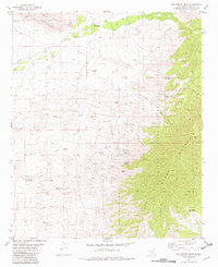
1981 Map of Golondrina Draw
USGS Topo · Published 1982About this map
Santo Niño de Atocha Ch Cem sits near the northern boundary of this high-desert landscape, offering a specific point of interest for genealogists tracing early Spanish-American settlement in Otero County. This 1982 publication illustrates a remote region defined by its water sources, where named springs like Armijo Spring and Maverick Spring and infrastructure such as Schoolhouse Well were vital to life and livestock. The map documents the western edge of the Mescalero Apache Indian Reservation as it meets the rising slopes of the Black Mountains.
Find a feature on this map
36 named features on this map. Tap any name to fly to it.
Don’t see what you’re looking for? This feature index may not catch every label — zoom into the map to look around manually.
Map Details
Editions of this 1981 Golondrina Draw Map
This is the sole edition of this map. No revisions or reprints were ever made.
Other maps of this area

1916 · Tularosa
USGS Topo · 1:125,000

1947 · Three Rivers
USGS Topo · 1:62,500

1948 · Tularosa
USGS Topo · 1:62,500

1950 · Three Rivers
USGS Topo · 1:24,000

1950 · Oscura
USGS Topo · 1:24,000

1950 · Sierra Blanca Peak
USGS Topo · 1:62,500

1950 · Mescalero
USGS Topo · 1:62,500

1954 · Tularosa
USGS Topo · 1:250,000

1955 · Roswell
USGS Topo · 1:250,000

1958 · Roswell
USGS Topo · 1:250,000