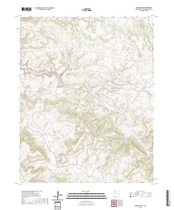
2023 Map of Gomez Ranch
USGS Topo · Published 2023About this map
La Jara Creek and its associated La Jara Canyon dominate this high-desert landscape in northern New Mexico. The drainage patterns of La Jara Wash and Frances Creek illustrate the complex watershed of this region, where seasonal water flow has carved distinct landforms like La Fragua Canyon and Laguna Seca Draw. This modern survey by the U.S. Geological Survey reveals a sparsely populated terrain primarily defined by public land survey boundaries and a handful of rural roads, including Co RD 362 and Co RD 513. The absence of dense settlement highlights the continuity of this open ranching and wilderness area, where the primary human footprint is found in the network of county routes and the occasional trace of Manuel Canyon along the eastern boundary.
Find a feature on this map
16 named features on this map. Tap any name to fly to it.
Don’t see what you’re looking for? This feature index may not catch every label — zoom into the map to look around manually.
Map Details
Editions of this 2023 Gomez Ranch Map
This is the sole edition of this map. No revisions or reprints were ever made.
Other maps of this area

1889 · Largo
USGS Topo · 1:250,000

1895 · Largo
USGS Topo · 1:250,000

1954 · Pine River
USGS Topo · 1:24,000
1954 · Burnt Mesa
USGS Topo · 1:24,000

1954 · Rosa
USGS Topo · 1:24,000

1954 · Gomez Ranch
USGS Topo · 1:24,000

1954 · Aztec
USGS Topo · 1:250,000

1958 · Aztec
USGS Topo · 1:250,000

1959 · Gould Pass
USGS Topo · 1:62,500

1959 · Navajo Dam
USGS Topo · 1:62,500