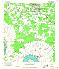
1961 Map of Gonzales
USGS Topo · Published 1967About this map
Gonzales serves as the central hub of this Ascension Parish landscape, where the New River and a dense network of bayous dictate the patterns of settlement and drainage. To the south, the Mississippi River creates a dramatic arc at Point Houmas, flanked by the historic Belle Helene Plantation and the riverfront community of Burnside. The era’s industrial activity is evident in the extensive pipeline corridors and a significant tailings pond near the river, signaling the transition from traditional agriculture toward a modernizing economy. Numerous small churches and family-linked cemeteries, such as St Paul Ch, Mt Calvary Ch, and Orange Grove Cem, are scattered throughout the lowlands, providing critical geographic markers for genealogists and local historians tracing the heritage of communities like Marchandville and Cornerview.
Find a feature on this map
45 named features on this map. Tap any name to fly to it.
Don’t see what you’re looking for? This feature index may not catch every label — zoom into the map to look around manually.
Map Details
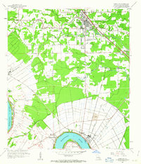
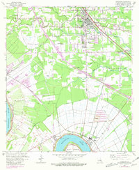
Editions of this 1961 Gonzales Map
3 editions found
Other maps of this area

1892 · Donaldsonville
USGS Topo · 1:62,500

1908 · Baton Rouge
USGS Topo · 1:62,500

1934 · Denham Springs
USGS Topo · 1:62,500

1935 · Gonzales
USGS Topo · 1:31,680

1936 · White Castle
USGS Topo · 1:62,500

1939 · Denham Springs
USGS Topo · 1:62,500

1939 · Baton Rouge
USGS Topo · 1:62,500

1939 · Donaldsonville
USGS Topo · 1:62,500

1946 · Convent
USGS Topo · 1:31,680

1947 · Donaldsonville
USGS Topo · 1:31,680