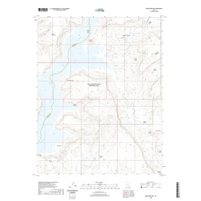
2020 Map of Good Hope Bay
USGS Topo · Published 2020About this map
Good Hope Bay and the submerged channel of the Colorado River define this portion of Lake Powell, where the water meets the high desert plateaus of San Juan and Garfield Counties. The landscape is marked by extreme relief, moving from the low-lying Ticaboo Number 1 Rapids and Ticaboo Number 2 Rapids to the heights of Mancos Mesa and the Red Rock Plateau. Notable geological formations rise directly from the water or the surrounding canyon floor, including Monte Cristo Island and the prominent Castle Butte.
Find a feature on this map
29 named features on this map. Tap any name to fly to it.
Don’t see what you’re looking for? This feature index may not catch every label — zoom into the map to look around manually.
Map Details
Editions of this 2020 Good Hope Bay Map
This is the sole edition of this map. No revisions or reprints were ever made.
Other maps of this area

1886 · Henry Mountains
USGS Topo · 1:250,000

1892 · Henry Mountains
USGS Topo · 1:250,000

1952 · Mancos Mesa
USGS Topo · 1:62,500

1952 · Mt Hillers
USGS Topo · 1:62,500

1952 · Mt Pennell 1 SE
USGS Topo · 1:24,000

1952 · Hite
USGS Topo · 1:62,500

1953 · Mt Pennell 4 NE
USGS Topo · 1:24,000

1953 · Mt. Ellsworth
USGS Topo · 1:62,500

1954 · White Canyon 3 SE
USGS Topo · 1:24,000

1954 · White Canyon 3 NW
USGS Topo · 1:24,000