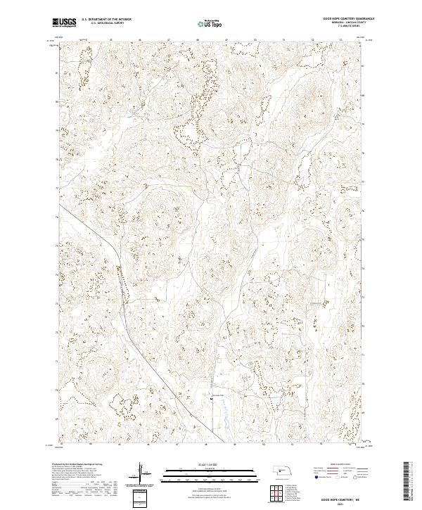
2021 Map of Good Hope Cemetery
USGS Topo · Published 2021About this map
Good Hope Cem stands as a focal point of this western Nebraska landscape, situated near the headwaters of White Horse Creek. This 2021 survey reveals a vast, sparsely populated terrain defined by its section lines and section corners, reflecting the enduring legacy of the Public Land Survey System. The region is largely defined by the townships of t16n r31w, t16n r30w, t15n r31w, and t15n r30w. Modern access to this rural expanse is provided by a thin network of unpaved corridors, most notably N Vierson Rd and N Johnson Rd, which trace the grid-like organization of the Lincoln County prairie. The absence of major settlements highlights the map's value for locating specific family landmarks and land tracts in a territory characterized by subtle topographic shifts and seasonal water drainage patterns.
Find a feature on this map
8 named features on this map. Tap any name to fly to it.
Don’t see what you’re looking for? This feature index may not catch every label — zoom into the map to look around manually.
Map Details
Editions of this 2021 Good Hope Cemetery Map
This is the sole edition of this map. No revisions or reprints were ever made.
Other maps of this area

1899 · North Platte
USGS Topo · 1:125,000

1902 · North Platte
USGS Topo · 1:125,000

1954 · North Platte
USGS Topo · 1:250,000

1956 · North Platte
USGS Topo · 1:250,000

1957 · North Platte
USGS Topo · 1:250,000

1967 · North Platte
USGS Topo · 1:250,000

1970 · North Platte East
USGS Topo · 1:24,000

1970 · North Platte West
USGS Topo · 1:24,000
1970 · Hershey East
USGS Topo · 1:24,000
1972 · North Platte 2 SW
USGS Topo · 1:24,000