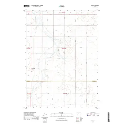
2018 Map of Goodell
USGS Topo · Published 2018About this map
The East Branch Iowa River meanders southward through this rural corridor, serving as the primary geographic focal point for the town of Goodell. This northern Iowa landscape is defined by a rigorous section-line grid of roads, such as Union Ave and 110th St, which partition the agricultural expanse. Near the center of the survey, the Amsterdam Cem stands as a quiet marker of the area's early settlement history. The terrain is characterized by numerous small depressions and wetlands common to this glaciated region, with Eldred Sherwood Park Lake providing a rare larger body of water. Along the southern edge, the Hancock Co Wright Co line marks the administrative transition across the prairie, while Luicks Cr drains the southeastern corner of the quadrangle.
Find a feature on this map
36 named features on this map. Tap any name to fly to it.
Don’t see what you’re looking for? This feature index may not catch every label — zoom into the map to look around manually.
Map Details
Editions of this 2018 Goodell Map
This is the sole edition of this map. No revisions or reprints were ever made.
Other maps of this area

1954 · Mason City
USGS Topo · 1:250,000

1954 · Waterloo
USGS Topo · 1:250,000

1955 · Waterloo
USGS Topo · 1:250,000

1957 · Mason City
USGS Topo · 1:250,000

1958 · Mason City
USGS Topo · 1:250,000

1972 · Cornelia
USGS Topo · 1:24,000

1972 · Alexander
USGS Topo · 1:24,000

1972 · Thornton
USGS Topo · 1:24,000

1972 · Olaf
USGS Topo · 1:24,000

1972 · Belmond
USGS Topo · 1:24,000