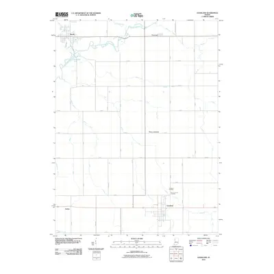
2010 Map of Goodland
USGS Topo · Published 2010About this map
The town of Goodland anchors the southern portion of this northern Indiana landscape, where the flat agricultural terrain is defined by a complex network of drainage infrastructure. Settled patterns of the early 21st century are visible in the grid of county roads and the layout of communities like Brook and the smaller Foresman. This area's hydrology is heavily modified, with the Iroquois River and its tributary Hickory Branch supplemented by numerous named waterworks such as the Simonin Ditch, Gushwa Ditch, and Montgomery Ditch. These features illustrate the extensive land reclamation required for the region's productivity. Local history and genealogy interests are represented by the Goodland Cemetery and Mount Calvary Cemetery, while smaller locales like Percy Junction and Perkins mark historically significant transit or gathering points across the rural township.
Find a feature on this map
51 named features on this map. Tap any name to fly to it.
Don’t see what you’re looking for? This feature index may not catch every label — zoom into the map to look around manually.
Map Details
Editions of this 2010 Goodland Map
This is the sole edition of this map. No revisions or reprints were ever made.
Other maps of this area

1953 · Danville
USGS Topo · 1:250,000

1955 · Danville
USGS Topo · 1:250,000

1956 · Danville
USGS Topo · 1:250,000

1961 · Kentland
USGS Topo · 1:24,000

1961 · Mount Ayr
USGS Topo · 1:24,000

1961 · Morocco
USGS Topo · 1:24,000

1962 · Mount Gilboa
USGS Topo · 1:24,000

1962 · Wadena
USGS Topo · 1:24,000

1962 · Goodland
USGS Topo · 1:24,000

1962 · Earl Park
USGS Topo · 1:24,000