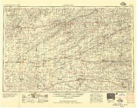
1956 Map of Goodland
USGS Topo · Published 1956This historical map portrays the area of Goodland in 1956, primarily covering Sherman County as well as portions of Sheridan County, Graham County, Wallace County, Thomas County, Norton County, Trego County, Decatur County, Logan County, Gove County, Cheyenne County, and Rawlins County. Featuring a scale of 1:250000, this map provides a highly detailed snapshot of the terrain, roads, buildings, counties, and historical landmarks in the Goodland region at the time. Published in 1956, it is the sole known edition of this map.
Find a feature on this map
107 named features on this map. Tap any name to fly to it.
Don’t see what you’re looking for? This feature index may not catch every label — zoom into the map to look around manually.
Map Details
Editions of this 1956 Goodland Map
This is the sole edition of this map. No revisions or reprints were ever made.
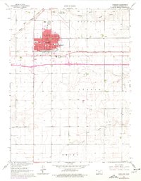
Historical Maps of Lenora Through Time
5 maps found