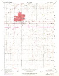
1966 Map of Goodland
USGS Topo · Published 1977About this map
The High Plains city of Goodland serves as the focal point of this mid-1960s survey, showing its development as a regional hub in Sherman County. The settlement is anchored by civic and industrial landmarks, including the Courthouse, City Hall, and the Powerplant. Educational institutions like Grant Sch, the High Sch, and the Northwest Kansas Vocational Sch indicate the community's growth during this era. Purple revision layers from the mid-1970s illustrate suburban expansion and road improvements around the central grid.
Find a feature on this map
29 named features on this map. Tap any name to fly to it.
Don’t see what you’re looking for? This feature index may not catch every label — zoom into the map to look around manually.
Map Details
Editions of this 1966 Goodland Map
3 editions found
Other maps of this area

1954 · Goodland
USGS Topo · 1:250,000

1956 · Goodland
USGS Topo · 1:250,000

1957 · Goodland
USGS Topo · 1:250,000

1959 · Harris Draw
USGS Topo · 1:62,500

1959 · Horsethief Draw
USGS Topo · 1:62,500

1966 · Goodland NW
USGS Topo · 1:24,000

1966 · Goodland
USGS Topo · 1:24,000

1966 · Edson
USGS Topo · 1:24,000

1966 · Ruleton NE
USGS Topo · 1:24,000

1966 · Goodland NE
USGS Topo · 1:24,000