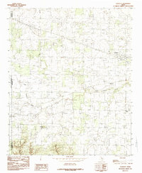
1984 Map of Goodlett
USGS Topo · Published 1985About this map
Goodlett serves as a primary settlement point in this section of Hardeman County, where the agricultural landscape meets the sharp relief of the Texas Panhandle fringe. The map documents a rural network of small communities including Wheatland, Lazare, and the descriptively named Punkin Center. The drainage pattern is defined by the winding paths of South Groesbeck Creek and Groesbeck Creek, which carve through the terrain toward the east. Prominent landmarks such as Hepsidam Hill and the seasonal flows within Spring Canyon illustrate the topographical character of the region. This 1970s-era field check preserves the road layouts and property boundaries of the county as they existed before modern expansion, capturing the intersection where Childress, Cottle, and Hardeman counties meet.
Find a feature on this map
11 named features on this map. Tap any name to fly to it.
Don’t see what you’re looking for? This feature index may not catch every label — zoom into the map to look around manually.
Map Details
Editions of this 1984 Goodlett Map
This is the sole edition of this map. No revisions or reprints were ever made.
Other maps of this area

1927 · Quanah 3-a
USGS Topo · 1:48,000

1927 · Quanah 3-b
USGS Topo · 1:48,000

1932 · Vivian
USGS Topo · 1:62,500

1954 · Plainview
USGS Topo · 1:250,000

1955 · Lawton
USGS Topo · 1:250,000

1958 · Plainview
USGS Topo · 1:250,000

1960 · Goodlett
USGS Topo · 1:62,500

1960 · Teacup Mountain
USGS Topo · 1:62,500

1967 · Kirkland South
USGS Topo · 1:24,000

1967 · Kirkland North
USGS Topo · 1:24,000