
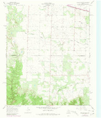
1967 Map of Kirkland South
USGS Topo · Published 1969About this map
The rolling plains of West Texas meet the steep relief of Ninety-foot Canyon on this survey of the Panhandle ranch lands. In the late 1960s, this landscape was defined by the transition from the relatively flat grazing lands south of South Groesbeck Creek to the more dissected terrain along Raggedy Creek. The Tennessee Valley Cemetery remains a significant marker for genealogists, situated near the boundary between Childress Co and Cottle Co. Transportation and industry are centered on the northern and southern edges of the sheet, with the Fort Worth and Denver railroad serving the upper corridor and the Quanah Acme and Pacific line crossing the lower section. Scattered Oil Well sites indicate the petroleum activity that complemented the traditional cattle ranching in this rural corner of the state.
Find a feature on this map
8 named features on this map. Tap any name to fly to it.
Don’t see what you’re looking for? This feature index may not catch every label — zoom into the map to look around manually.
Map Details
Editions of this 1967 Kirkland South Map
2 editions found
Other maps of this area

1927 · Quanah 3-b
USGS Topo · 1:48,000

1932 · Vivian
USGS Topo · 1:62,500

1954 · Plainview
USGS Topo · 1:250,000

1955 · Lawton
USGS Topo · 1:250,000

1958 · Plainview
USGS Topo · 1:250,000

1960 · Goodlett
USGS Topo · 1:62,500

1960 · Teacup Mountain
USGS Topo · 1:62,500

1967 · Buckle L Ranch
USGS Topo · 1:24,000

1967 · Kirkland North
USGS Topo · 1:24,000
1967 · Baker
USGS Topo · 1:24,000