
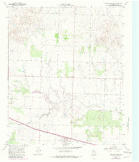
1967 Map of Kirkland North
USGS Topo · Published 1969About this map
The Fort Worth and Denver railroad corridor anchors this agricultural landscape in the late 1960s, cutting across the southern portion of the quadrangle. The settlement of Kirkland serves as a focal point for the local community, situated just north of the rail line and adjacent to the Kirkland Cem. The terrain is defined by the winding course of North Groesbeck Creek, which drains the undulating plains where numerous wells are marked, indicating the importance of groundwater for the region's ranching or farming operations. Small-scale industrial activity is evident through the presence of a Gravel Pit and larger Gravel Pits found near the creek beds. A solitary Community Center stands further north, suggesting a sparse but organized rural social structure during this period of Texas Panhandle history.
Find a feature on this map
8 named features on this map. Tap any name to fly to it.
Don’t see what you’re looking for? This feature index may not catch every label — zoom into the map to look around manually.
Map Details
Editions of this 1967 Kirkland North Map
2 editions found
Other maps of this area

1954 · Plainview
USGS Topo · 1:250,000

1955 · Lawton
USGS Topo · 1:250,000

1958 · Plainview
USGS Topo · 1:250,000

1960 · Goodlett
USGS Topo · 1:62,500

1960 · Loco
USGS Topo · 1:62,500

1961 · Hollis
USGS Topo · 1:62,500

1967 · Buckle L Ranch
USGS Topo · 1:24,000

1967 · Kirkland South
USGS Topo · 1:24,000

1967 · Childress
USGS Topo · 1:24,000
1984 · Goodlett
USGS Topo · 1:24,000