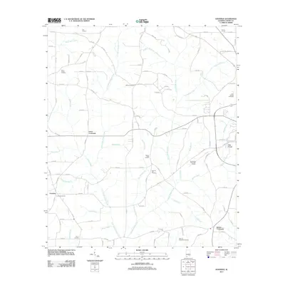
2011 Map of Goodman
USGS Topo · Published 2011About this map
The community of Goodman and the rural junction at Turner Crossroads anchor this Coffee County landscape in the early 2000s. The area is defined by a dense network of tributaries flowing into Double Bridges Creek and Little Double Bridges Creek, creating a varied terrain of creek branches and spring runs. Evidence of long-standing family and community heritage is visible in the numerous burial grounds scattered across the countryside, including Mount Calvary Cemetery, Bethany Cemetery, and Pleasant Ridge Cemetery.
Find a feature on this map
111 named features on this map. Tap any name to fly to it.
Don’t see what you’re looking for? This feature index may not catch every label — zoom into the map to look around manually.
Map Details
Editions of this 2011 Goodman Map
This is the sole edition of this map. No revisions or reprints were ever made.
Other maps of this area

1942 · Enterprise
USGS Topo · 1:125,000

1950 · Enterprise
USGS Topo · 1:62,500

1953 · Andalusia
USGS Topo · 1:250,000

1953 · Dothan
USGS Topo · 1:250,000

1954 · Dothan
USGS Topo · 1:250,000

1955 · Dothan
USGS Topo · 1:250,000

1957 · Andalusia
USGS Topo · 1:250,000

1957 · Geneva
USGS Topo · 1:62,500

1957 · Bellwood
USGS Topo · 1:24,000
1957 · Coffee Springs
USGS Topo · 1:24,000