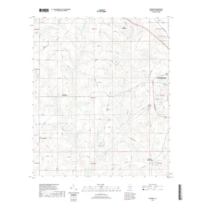
2018 Map of Goodman
USGS Topo · Published 2018About this map
New Brockton sits at the northern edge of this Coffee County landscape, where the topography is defined by a dense network of creek branches and spring runs. The western outskirts of Enterprise push into the eastern boundary, marked by the Enterprise Municipal Airport and the corridor of the bypass. Between these population centers lies a rural expanse of crossroads settlements, including Turner Crossroads, Battens Crossroads, and the map's namesake, Goodman. This area is characterized by family-named landmarks and historical burial grounds, such as Goodman Cem and Asbury Cem, which reflect generations of local settlement. The drainage pattern is intricate, with numerous small waterways like Wooten Mill Cr, Double Bridges Cr, and Peacock Mill Br carving through the terrain, suggesting a long history of water-powered milling and agricultural utility in this part of southeastern Alabama.
Find a feature on this map
125 named features on this map. Tap any name to fly to it.
Don’t see what you’re looking for? This feature index may not catch every label — zoom into the map to look around manually.
Map Details
Editions of this 2018 Goodman Map
This is the sole edition of this map. No revisions or reprints were ever made.
Other maps of this area

1942 · Enterprise
USGS Topo · 1:125,000

1950 · Enterprise
USGS Topo · 1:62,500

1953 · Andalusia
USGS Topo · 1:250,000

1953 · Dothan
USGS Topo · 1:250,000

1954 · Dothan
USGS Topo · 1:250,000

1955 · Dothan
USGS Topo · 1:250,000

1957 · Andalusia
USGS Topo · 1:250,000

1957 · Geneva
USGS Topo · 1:62,500

1957 · Bellwood
USGS Topo · 1:24,000
1957 · Coffee Springs
USGS Topo · 1:24,000