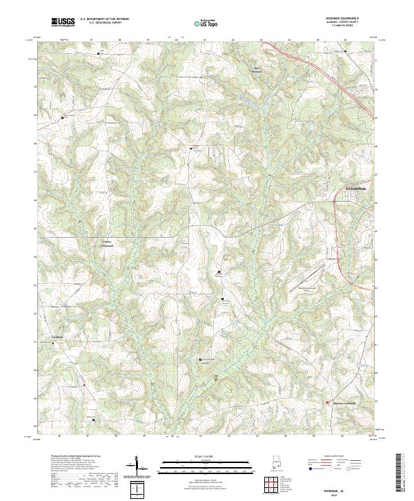
2024 Map of Goodman
USGS Topo · Published 2024About this map
New Brockton and the western periphery of Enterprise anchor this modern-day topographic study of rural Coffee County. The landscape is defined by the winding drainages of Double Bridges Creek and Martin Spring Branch, which carve through the undulating terrain north of the Goodman settlement. Genealogists will find a high concentration of burial sites throughout the quadrangle, including the Bethany Baptist Church Cem and Mount Calvary Cem, providing a precise map of established family and community landmarks. Transportation is centered on the local road network and the Enterprise Municipal Airport, while the southern reaches of the map near Battens Crossroads transition into more open country marked by Rocky Branch. This survey illustrates the persistent rural character of the Alabama Wiregrass region, where small crossroads like Turner Crossroads remain focal points for the surrounding agricultural tracts and timberlands.
Find a feature on this map
89 named features on this map. Tap any name to fly to it.
Don’t see what you’re looking for? This feature index may not catch every label — zoom into the map to look around manually.
Map Details
Editions of this 2024 Goodman Map
This is the sole edition of this map. No revisions or reprints were ever made.
Other maps of this area

1942 · Enterprise
USGS Topo · 1:125,000

1950 · Enterprise
USGS Topo · 1:62,500

1953 · Andalusia
USGS Topo · 1:250,000

1953 · Dothan
USGS Topo · 1:250,000

1954 · Dothan
USGS Topo · 1:250,000

1955 · Dothan
USGS Topo · 1:250,000

1957 · Andalusia
USGS Topo · 1:250,000

1957 · Geneva
USGS Topo · 1:62,500

1957 · Bellwood
USGS Topo · 1:24,000
1957 · Coffee Springs
USGS Topo · 1:24,000