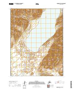
2019 Map of Goodnews Bay A-2 SE
USGS Topo · Published 2019About this map
Ualik Lake dominates the central landscape of this wilderness area within the Dillingham Census Area of Alaska. This 2019 survey documents a complex network of glacial and alluvial water systems, including the Tuklung River in the southeast and the Kanik River winding through the western flats. The terrain is defined by dramatic elevation changes, with ridges rising sharply from the eastern shore of the lake. The northwestern corner is marked by the course of Tithe Cr, which flows through the rugged highlands. The mapping reflects a remote, unpopulated territory where traditional land divisions like t12s r61w and t13s r61w overlay a landscape shaped almost entirely by natural hydrology and topography rather than human settlement.
Find a feature on this map
8 named features on this map. Tap any name to fly to it.
Don’t see what you’re looking for? This feature index may not catch every label — zoom into the map to look around manually.
Map Details
Editions of this 2019 Goodnews Bay A-2 SE Map
This is the sole edition of this map. No revisions or reprints were ever made.
Other maps of this area

1945 · Nushagak Bay
USGS Topo · 1:250,000

1949 · Nushagak Bay
USGS Topo · 1:250,000

1950 · Nushagak Bay D-5
USGS Topo · 1:63,360

1951 · Goodnews
USGS Topo · 1:250,000

1951 · Nushagak Bay
USGS Topo · 1:250,000

1964 · Nushagak Bay
USGS Topo · 1:250,000
1979 · Goodnews Bay A-1
USGS Topo · 1:63,360

1979 · Goodnews Bay
USGS Topo · 1:250,000
1979 · Goodnews Bay A-2
USGS Topo · 1:63,360
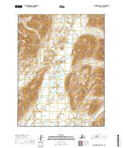
2019 · Goodnews Bay A-2 NW
USGS Topo · 1:25,000