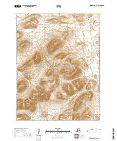
2017 Map of Goodnews Bay A-7 SE
USGS Topo · Published 2017About this map
Iktliyagak Mtn and Tgolik Mtn anchor the high ground in this southwestern Alaska landscape, where the terrain transitions from steep peaks to low-lying wetlands. The drainage systems are the primary geographical markers here, with the Puyulik Cr winding through the western hills and the Kinegnak River flowing across the southern reaches. This 2017 survey documents a largely unpeopled wilderness within the Bethel Census Area, focusing on the intricate contour lines of Dome Mtn and the numerous unnamed small ponds that dot the marshy plains. The lack of roads or infrastructure highlights the isolation of this region, where the natural watercourses like Kinegnak Cr define the movement of the land. It is a snapshot of an untouched environment, valuable for studying the hydrology and elevation of the Goodnews Bay area.
Find a feature on this map
10 named features on this map. Tap any name to fly to it.
Don’t see what you’re looking for? This feature index may not catch every label — zoom into the map to look around manually.
Map Details
Editions of this 2017 Goodnews Bay A-7 SE Map
This is the sole edition of this map. No revisions or reprints were ever made.
Other maps of this area

1950 · Hagemeister Island D-5
USGS Topo · 1:63,360

1951 · Goodnews
USGS Topo · 1:250,000

1951 · Hagemeister Island
USGS Topo · 1:250,000

1954 · Goodnews A-7
USGS Topo · 1:63,360

1954 · Hagemeister Island D-5
USGS Topo · 1:63,360

1954 · Hagemeister Island D-4
USGS Topo · 1:63,360

1954 · Goodnews A-6
USGS Topo · 1:63,360

1957 · Hagemeister Island
USGS Topo · 1:250,000

1979 · Goodnews Bay
USGS Topo · 1:250,000
2017 · Goodnews Bay A-7 SW
USGS Topo · 1:25,000