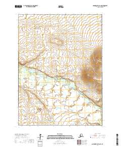
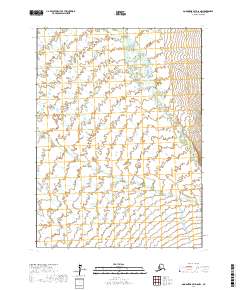
2017 Map of Goodnews Bay D-6 SW
USGS Topo · Published 2017About this map
The Kanektok River dominates this landscape in the Bethel Census Area of southwest Alaska, winding through the center of the terrain as it flows toward the coast. This 2017 survey reflects the remote character of the region, where the hydrology is the primary defining feature of the land. The river’s path, documented through data from the National Hydrography Dataset, demonstrates the dynamic nature of this subarctic waterway as it carves through the undulating topography. Without established roads or settlements, the map provides a focused view of the wilderness within the Public Land Survey System township and range grid, specifically covering portions of T3S through T5S. The absence of human infrastructure highlights the area's preservation and the natural drainage patterns of the river system.
Find a feature on this map
7 named features on this map. Tap any name to fly to it.
Don’t see what you’re looking for? This feature index may not catch every label — zoom into the map to look around manually.
Map Details
Editions of this 2017 Goodnews Bay D-6 SW Map
This is the sole edition of this map. No revisions or reprints were ever made.
Other maps of this area

1951 · Goodnews
USGS Topo · 1:250,000

1954 · Goodnews C-7
USGS Topo · 1:63,360

1954 · Goodnews D-6
USGS Topo · 1:63,360

1954 · Goodnews D-7
USGS Topo · 1:63,360

1954 · Goodnews C-6
USGS Topo · 1:63,360

1979 · Goodnews Bay
USGS Topo · 1:250,000
2017 · Goodnews Bay C-6 NW
USGS Topo · 1:25,000
2017 · Goodnews Bay D-7 SE
USGS Topo · 1:25,000
2017 · Goodnews Bay C-7 NE
USGS Topo · 1:25,000
2017 · Goodnews Bay D-6 NW
USGS Topo · 1:25,000