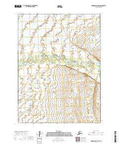
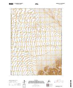
2017 Map of Goodnews Bay D-7 SE
USGS Topo · Published 2017About this map
The Kanektok River flows westward through this remote landscape in the Bethel Census Area, creating a complex network of braids and oxbows across the tundra. This 2017 survey by the U.S. Geological Survey captures the hydrologic patterns of the region, where the river serves as a primary geographic corridor. To the south, the terrain rises slightly into upland areas drained by Magaktlek Cr, while Klaktak Cr appears in the northeast corner. The lack of roads or established settlements on this map underscores the wild nature of the Alaskan wilderness, where natural watercourses and Public Land Survey System boundaries, such as t4s r71w and t4s r70w, provide the only navigational markers.
Find a feature on this map
9 named features on this map. Tap any name to fly to it.
Don’t see what you’re looking for? This feature index may not catch every label — zoom into the map to look around manually.
Map Details
Editions of this 2017 Goodnews Bay D-7 SE Map
This is the sole edition of this map. No revisions or reprints were ever made.
Other maps of this area

1951 · Goodnews
USGS Topo · 1:250,000

1954 · Goodnews C-7
USGS Topo · 1:63,360

1954 · Goodnews D-6
USGS Topo · 1:63,360

1954 · Goodnews D-7
USGS Topo · 1:63,360

1954 · Goodnews C-6
USGS Topo · 1:63,360

1979 · Goodnews Bay
USGS Topo · 1:250,000
2017 · Goodnews Bay C-6 NW
USGS Topo · 1:25,000
2017 · Goodnews Bay C-7 NW
USGS Topo · 1:25,000
2017 · Goodnews Bay D-6 SW
USGS Topo · 1:25,000
2017 · Goodnews Bay C-7 NE
USGS Topo · 1:25,000