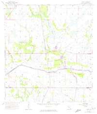
1958 Map of Goodno
USGS Topo · Published 1974About this map
Ortona and the surrounding marshlands of Glades and Hendry Counties appear here during a period of transition in the mid-20th century. The landscape is defined by the engineered path of the Caloosahatchee River and the Caloosahatchee Canal, which serve as the primary hydrologic artery through the region. Significant archaeological and cultural markers are present, including an Indian Mound and the Ortona Cem, while the Ortona Ch. and the settlement at Goodno anchor the local community.
Find a feature on this map
20 named features on this map. Tap any name to fly to it.
Don’t see what you’re looking for? This feature index may not catch every label — zoom into the map to look around manually.
Map Details
Editions of this 1958 Goodno Map
2 editions found
Other maps of this area

1956 · West Palm Beach
USGS Topo · 1:250,000

1957 · West Palm Beach
USGS Topo · 1:250,000

1958 · West Palm Beach
USGS Topo · 1:250,000

1958 · La Belle NW
USGS Topo · 1:24,000

1958 · Goodno
USGS Topo · 1:24,000

1958 · Felda NE
USGS Topo · 1:24,000

1958 · Sears
USGS Topo · 1:24,000
1958 · La Belle
USGS Topo · 1:24,000
1958 · Palmdale
USGS Topo · 1:24,000
1970 · Lakeport
USGS Topo · 1:24,000