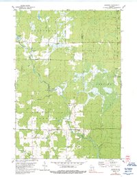
1980 Map of Goodrich
USGS Topo · Published 1992About this map
Goodrich and Interwald anchor this mid-1970s landscape at the boundary of Taylor and Lincoln counties. The rural character is defined by a dense network of waterways, including the winding Big Rib River and its many tributaries like Lemke Creek, Mink Creek, and Joe Martin Creek. An Old Railroad Grade running through the southern section indicates the region's former reliance on rail for transporting timber or local goods, while numerous Gravel Pits suggest the importance of local material extraction for road maintenance and construction during this era.
Find a feature on this map
26 named features on this map. Tap any name to fly to it.
Don’t see what you’re looking for? This feature index may not catch every label — zoom into the map to look around manually.
Map Details
Editions of this 1980 Goodrich Map
2 editions found
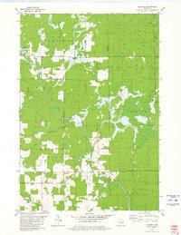
Other maps of this area

1902 · Marathon
USGS Topo · 1:125,000

1945 · Rib Lake
USGS Topo · 1:48,000

1947 · Rib Lake
USGS Topo · 1:48,000

1949 · Rib Lake
USGS Topo · 1:48,000

1950 · Spirit Falls
USGS Topo · 1:48,000

1951 · Athens
USGS Topo · 1:48,000

1951 · Hamburg
USGS Topo · 1:48,000

1952 · Spirit Falls
USGS Topo · 1:48,000

1953 · Rice Lake
USGS Topo · 1:250,000

1954 · Iron Mountain
USGS Topo · 1:250,000